The iRecord App makes it easy to create and upload biological record observations of any species in the field. These are linked to your account on the iRecord website, where records can be verified by national recording schemes and societies, and are made available to Local Environmental Records Centres (LERCs). The app is available for Android and iPhone.
Here we introduce some of the newer features of the app:
2. Recording lists for plant/moth/general surveys.
3. Linking to activities you’ve joined on the website.
4. Automatic image recognition to aid with ID.
5. Extensive list of stage options for invertebrates.
6. Geolocating survey entries.
7. Notification on entering a new grid square for plant & species list surveys.
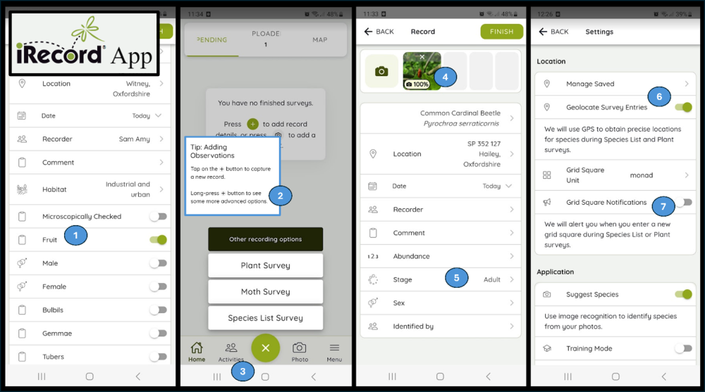
1. Specific attributes on the casual recording form offered for certain groups (e.g. birds, bryophytes, dragonflies).
For a growing number of taxonomic groups, the app will return a list of taxon-specific attributes once you enter the species name. For example, allowing you to record whether your specimen is ‘fruiting’, male, female, with bulbils, tubers etc. for bryophytes, the breeding status for birds, and abundance categories for different statuses for dragonflies.
2. Recording lists for plant/moth/general surveys.
As well as adding individual ad hoc observations by tapping once on the + button, there are options available to make it easier to record lists in a single location, either for moths, plants, or general species. Find these by long pressing the + button.
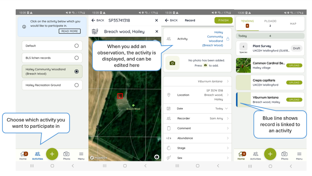
3. Linking to activities you’ve joined on the website.
You can join activities on the iRecord Activities page, and then select via the Activities button at the bottom of the app home screen which, if any, you would like your observations to be linked to. The activity you have chosen is then displayed at the top of your observation, which you can edit again here if you choose.
4. Automatic image recognition to aid with ID.
If you have added a photo to your record, the app will offer suggestions about the identification, using automatic image recognition.
- If you add a record using the plus button, you will be asked to add a species name to your record first. You can then add one or more photos, and the app will tell you if it agrees with the species name. If not, it may suggest a different identification.
- If you add a record using the photo button, you can add a photo first, and the app will be able to suggest an identification. You can then go on to use the suggested species name if you agree with it or add your own identification instead.
After uploading the photo, check the thumbnail to see if it shows a percentage indicating the probability of a suggested identification. If a different identification is being suggested a small red warning circle will be displayed – open the thumbnail to see alternative identification suggestions. When you open the thumbnail image, you can tap on any of the alternative suggestions shown, and that will set the identification for your record.
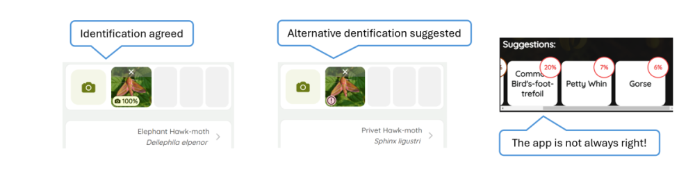
The image recognition process can be very helpful, but it doesn’t get it right every time! Check what is being suggested before making your final decision, and if you think the app suggestion is wrong feel free to stick to your own identification.
5. Extensive list of stage options for invertebrates.
The options to select from for the stage of invertebrates has been extended to include various stages applicable to different taxonomic groups (e.g. exuvia, larval web, nymph, gall).
6. Geolocating survey entries.
One of the main benefits of using the app in the field is that it collects allows for automatic collection of the GPS locations you select from the map display. It is also now possible to choose whether the app will automatically use GPS to obtain precise locations for observations made during Species List and Plant surveys. For example, you may have selected a 1km square as the location for your plant survey, but with the Geolocation Survey Entries function switched on, a precise location will be automatically saved with each observation.
7. Notification on entering a new grid square for plant & species list surveys.
Some recording schemes have traditionally recorded lists of species found within grid squares, one example being the Botanical Society for Britain and Ireland for vascular plants. For such recording the app provides ‘Species List’ and ‘Plant Survey’ forms, both of which allow you to choose a location such as a 1km grid square to record within. Whilst using these forms it is possible to enable the app to notify you when you move outside of the grid square.