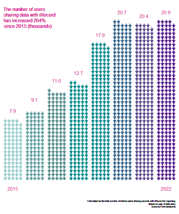
In the past year over 2.2 million records were received and verified, including nearly 1.5 million photos, by almost 21,000 users.
Monthly exports of c. 62 biological record datasets continue to be sent from iRecord to NBN Atlas, with new datasets being added to the list over time. A substantial addition in February 2023 was the inclusion of reptile and amphibian records, following liaison with Amphibian and Reptile Conservation (ARC) and Amphibian and Reptile Groups UK (ARG UK).
Various updates to the iRecord verification systems are being implemented in partnership with Butterfly Conservation’s “Supporting Science” project (which received DCMS and National Lottery funding, distributed by The Heritage Fund as part of their Digital Skills for Heritage initiative). New verification tools are being tested to make it easier to deal with records that have photos; the spreadsheet upload tool has been improved to make it easier to use and more effective in checking the records prior to import; and a number of other enhancements are in progress.
Further work to improve the iRecord verification process as part of Natural Capital and Ecosystem Assessment (NCEA; a Defra-managed partnership programme) is also ongoing, and we are very grateful to all those verifiers who have responded to questionnaires and follow up interviews. The analysis of feedback is ongoing and will be very useful in informing future developments to improve the iRecord experience for everyone.
We continue to welcome, with the support of the relevant national schemes, a regular stream of new verifiers to whom we and all iRecord users are very grateful for their time and expertise in this important role. For further information on verification see this guidance, and for schemes wishing to discuss how verification permissions can be implemented at different geographic and taxonomic scales, please contact [email protected].
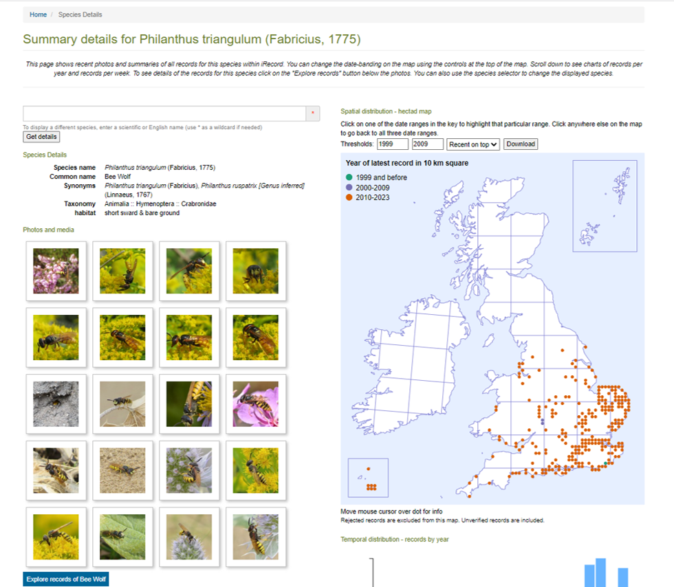
New species summary pages are available to all users in iRecord, which include species details and a photograph gallery, charts showing the temporal distribution of records by week and year, and interactive maps of records. The maps can be interrogated to show the earliest and latest record for each hectad, and also show three date classes, the overall range of which can be selected by the user. There is also a button to download maps to a png file.
Once you are logged in to the web version of iRecord, you can find these pages here.